
Bluberri · Inteligencia operacional · Minería · Defensa e infraestructura crítica
Múltiples fuentes. Un solo panorama operacional.
Conecte sistemas, sensores y reportes de campo en un panorama común, con alertas y trazabilidad.
-
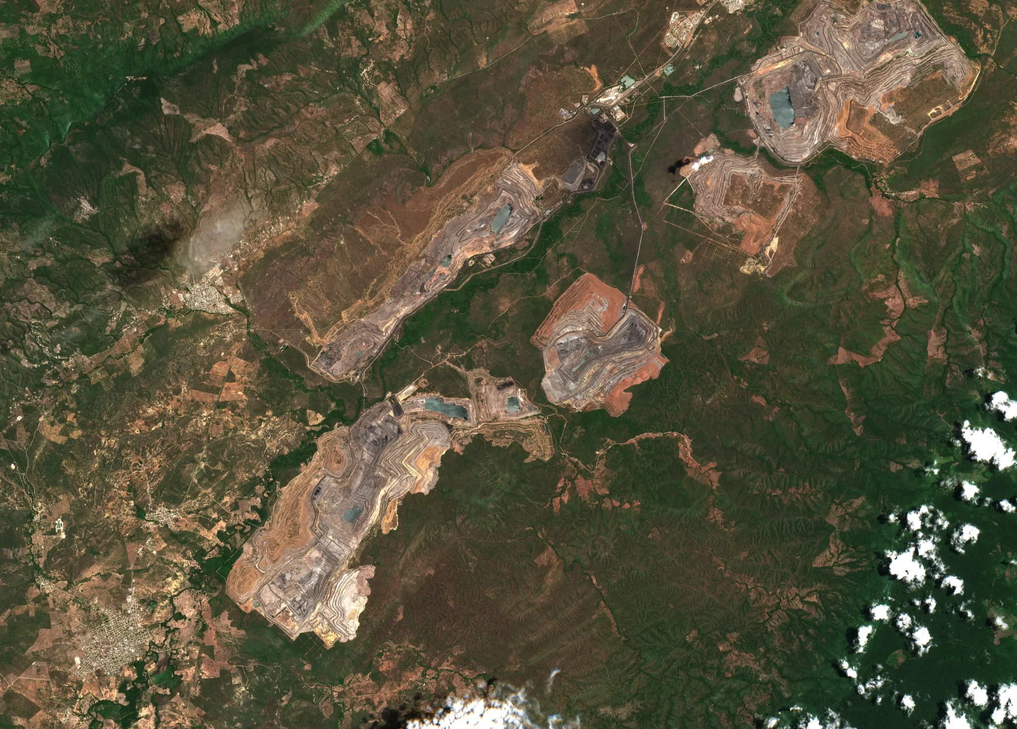
01 / 03 · Los datos existen
Los datos existen. Viven repartidos.
Un reporte de campo, un sensor conectado, la consola de cada sistema, una pasada satelital.
Color real · Sentinel-2 · 10 m por píxel
-
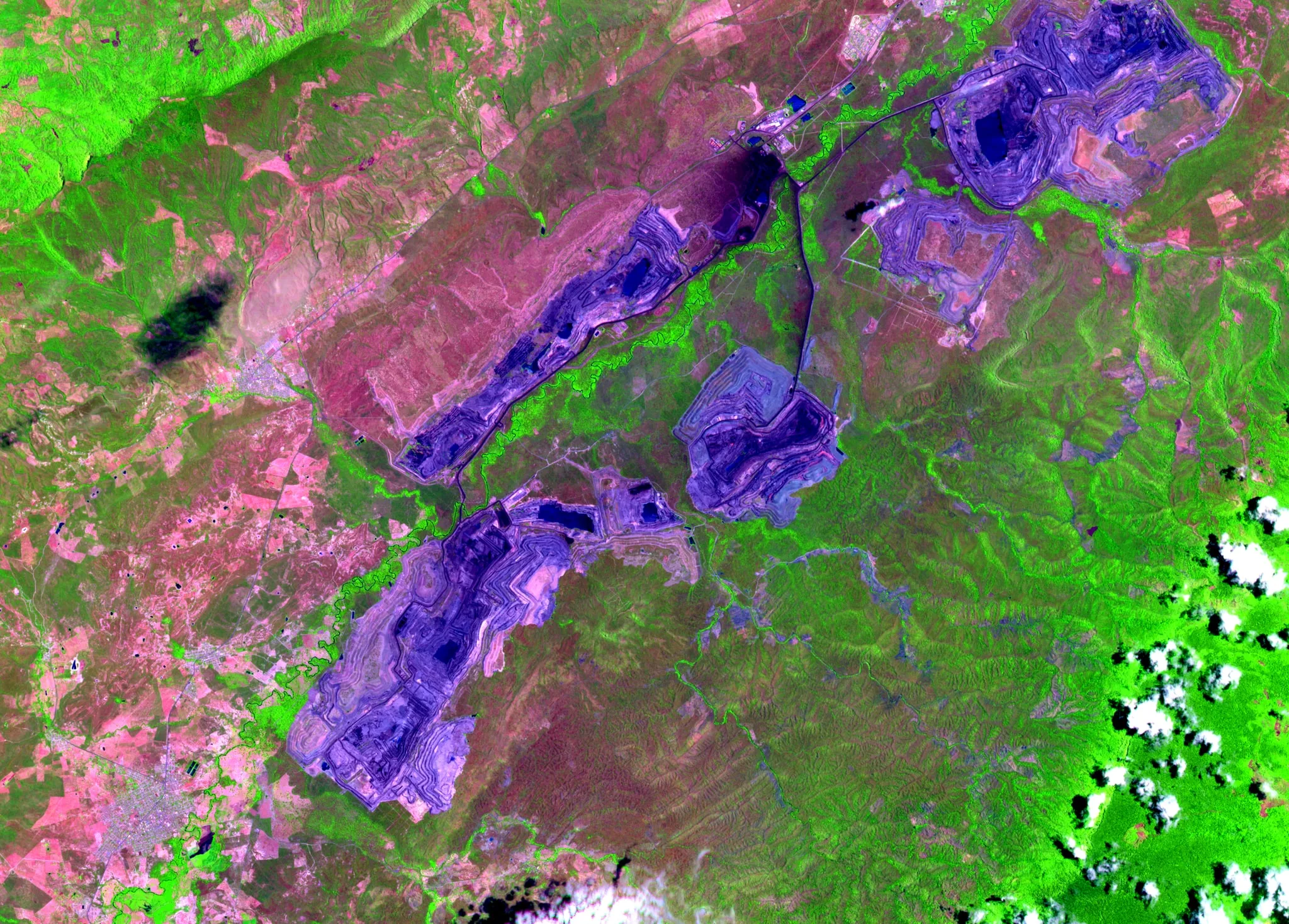
02 / 03 · Bluberri los une
Bluberri los une.
Nueve entidades traducen cada fuente a un mismo idioma.
SWIR · NIR · rojo: tres bandas que el ojo no ve, en una sola imagen
-
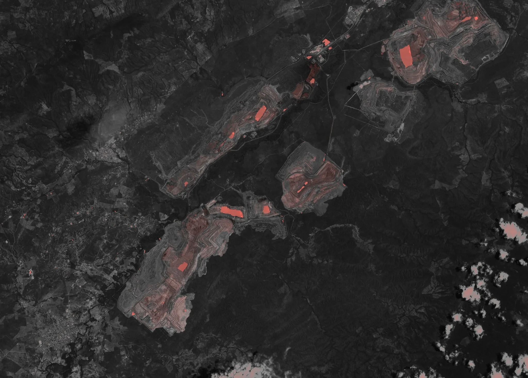
03 / 03 · Alertas con evidencia
Alertas con evidencia.
Una regla explícita convierte la señal en hallazgo; el hallazgo lleva responsable, plazo y prueba de cierre.
NDWI (B03 / B08): agua y humedad superficial en coral · marcadores ilustrativos


Modelo común de datos
¿Cómo se ve?
Empieza por un inventario de fuentes de información para cruzar, analizar y decidir.
Nos enganchamos donde el dato ya está estructurado. El fabricante sigue siendo responsable de su hardware.
-
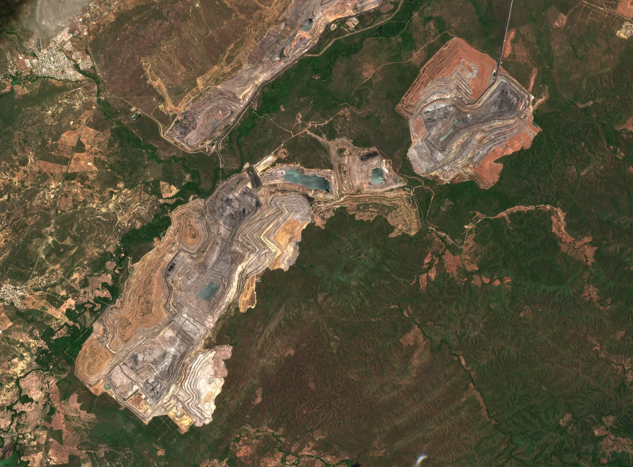
Tajos de carbón, La Guajira, Colombia · Color real · 10/08/2026 -
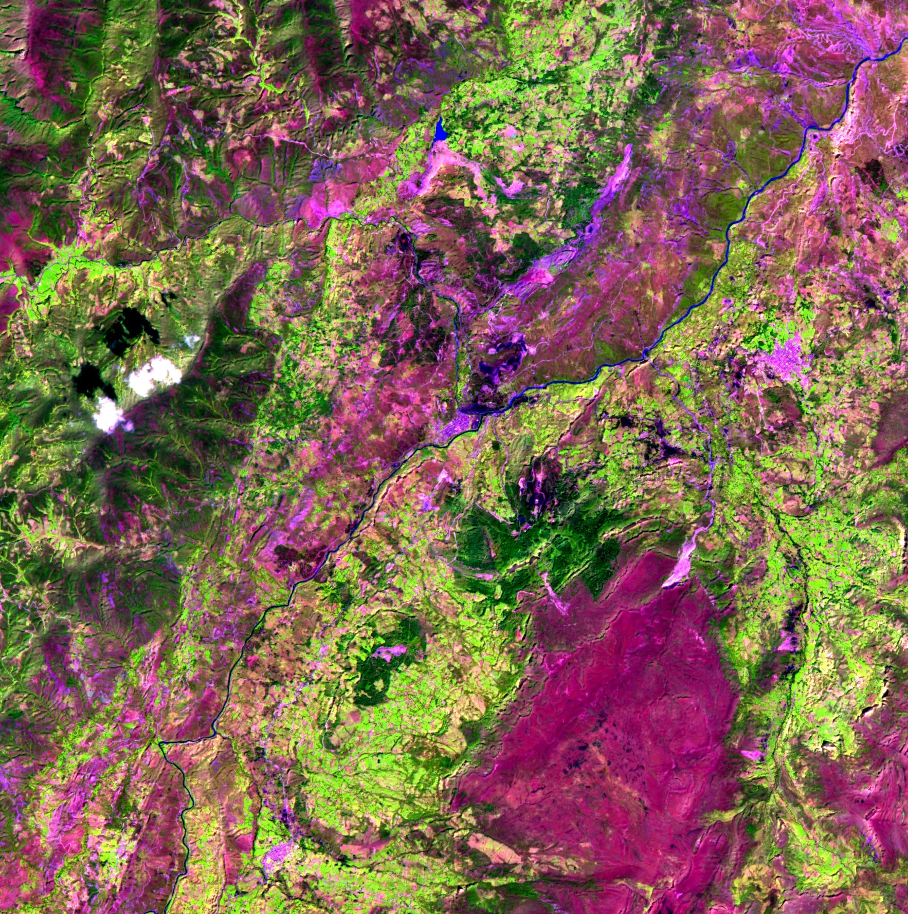
Cuenca minera de hierro y carbón, Boyacá, Colombia · SWIR · NIR · Rojo · 15/12/2025 -
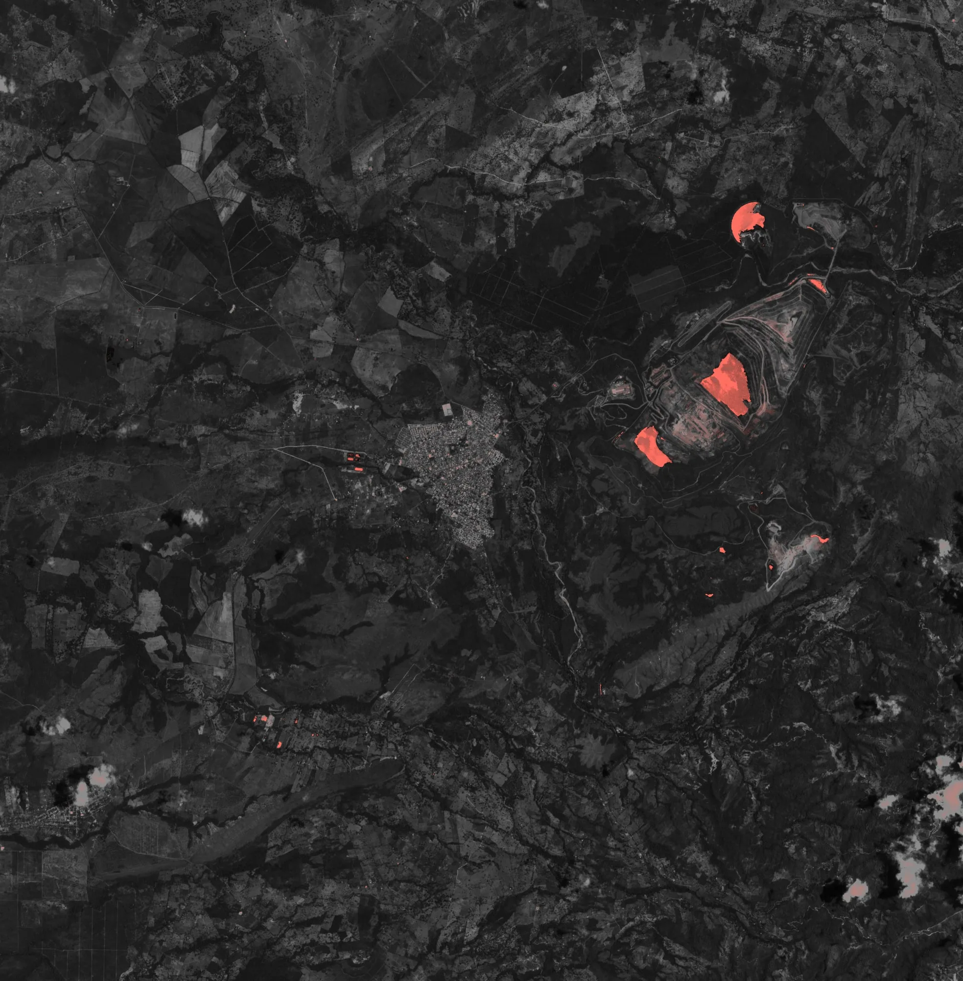
Carbón a cielo abierto, Cesar, Colombia · NDWI · agua en coral · 25/08/2026 -
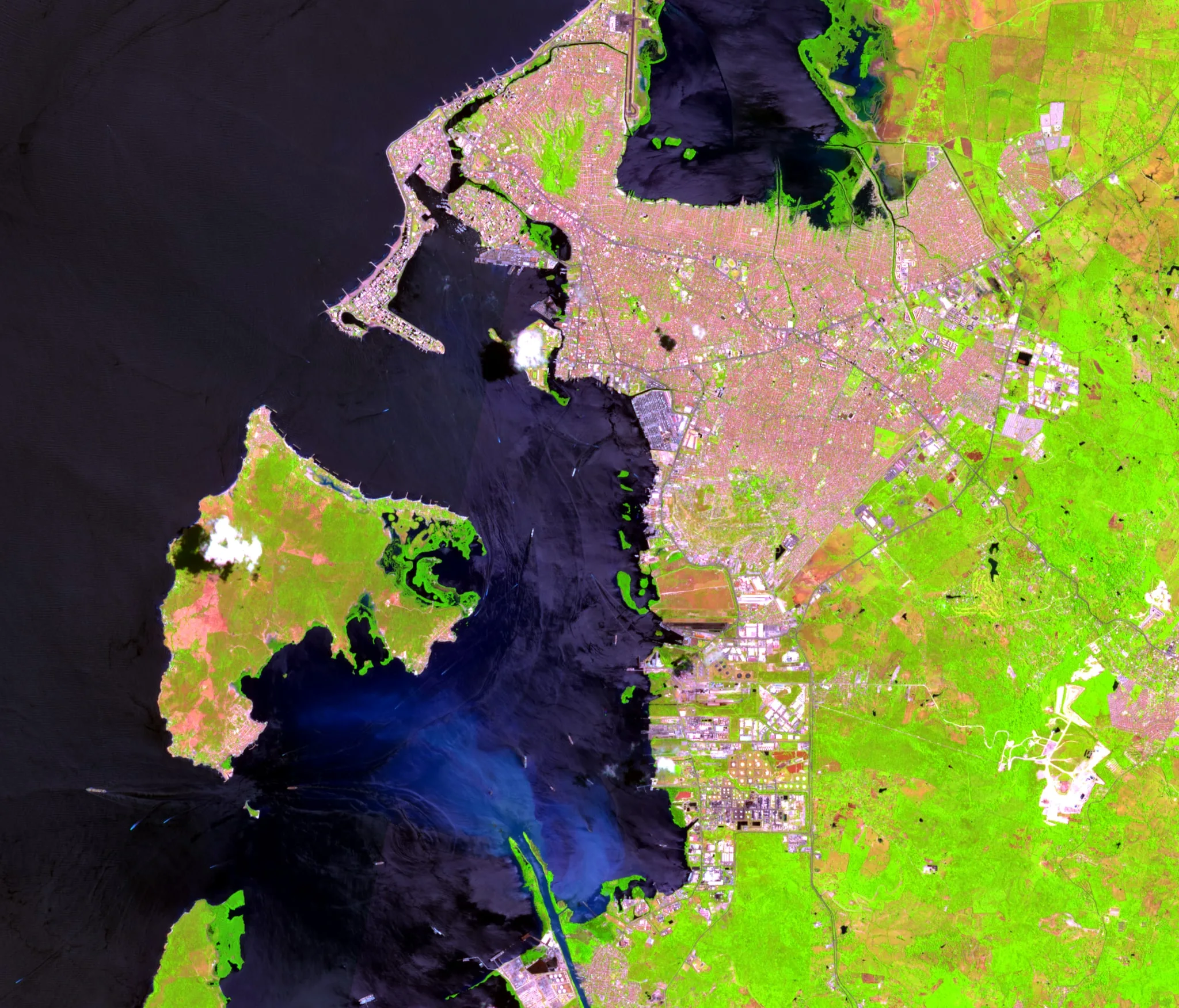
Bahía de Cartagena, Colombia · SWIR · NIR · Rojo · 29/07/2026


← Deslice para ver las cuatro escenas →
Cómo se sostiene
-
Un modelo que centraliza fuentes
Sumar nuevas fuentes mejora el catálogo de variables, siempre con una estructura igual.
-
Se transfiere entre mundos
Desde leyes de minerales, concentración de gas o activos eléctricos, hasta información satelital, aérea y marítima.
-
No reemplaza sus sistemas
Alimenta los que ya operan y consume de ellos. No decide por el operador ni es otro tablero.
Entradas
Minería · Operación industrial
- WhatsApp: reportes de campo: texto, voz y foto
- Hojas de cálculo: HSE y producción, formato versionado
- Detectores de gases: vía la nube del fabricante
- Ventilación: y monitoreo atmosférico
- SCADA e historiadores: gateway de borde, solo publica afuera
- Telemetría de flota: estándar ISO 15143-3
- Entregables de aliados: dron, topografía, ROV
- Imágenes satelitales: a cielo abierto
Defensa · aérea y marina · Misión
- Sistemas aéreos autónomos: telemetría, posición, estado de misión
- Guerra electrónica y RF: estado del sistema, eventos, ubicación
- Vehículos submarinos: misión, sonar, posición, hallazgos
- Cámaras y sonar
- Fuentes externas: de información
Entidades
- Sitio
- La operación: la mina, la unidad, la base.
- Labor
- Frente, galería, nivel o tajo. En otra vertical, un activo eléctrico o un tramo de tubería.
- Medición
- Una lectura puntual de una variable, con hora de captura y hora de ingreso.
- Variable
- Qué se mide y con qué umbrales: gases, ventilación, geomecánica, eléctrico, ley.
- Hallazgo
- Una condición insegura detectada por una regla, un operador o una revisión.
- Acción
- Qué se hizo con el hallazgo: responsable, plazo, evidencia y cierre.
- Fuente
- De dónde vino el dato: sistema, método de ingesta, latencia y confiabilidad.
- Persona
- Quien captura o actúa, con su rol y su turno.
- Turno
- La ventana operativa en la que ocurre todo lo anterior.
Salidas
- Datos de operación · Datos de misión
- Consolidados por operación, con su trazabilidad. Consolidados por misión, con su trazabilidad.
- Panorama operacional común
- Posición, estado, alertas y hallazgos de todos los sistemas en una misma vista.
- Trazabilidad
- Cada dato con hora de captura, origen y responsable.
- Análisis
- Sobre los mismos datos trazables, con su origen a la vista.
- Alertas · responsable · plazo
- Nacen de reglas explícitas y auditables.
- Reportes exportables
- Con estructura fija, exportables.
Capa de inteligencia operacional y de misión
Una misión. Múltiples sistemas. Una sola capa operacional.
Aeris se integra con los sistemas de mando y control, de operación y de gestión que la institución o la operación ya usa. No los reemplaza: los alimenta y consume información de ellos.
Principios
-
01
Se integra, no reemplaza
Alimenta y consume los sistemas que ya operan, sin atarse a un solo fabricante de hardware.
-
02
Decisión asistida, responsabilidad humana
Aeris no decide por el operador ni certifica nada; hace visible y difícil de ignorar lo que importa.
-
03
Evidencia trazable
Origen, hora y responsable en cada dato.
Bluberri cuenta con una red global de aliados.
Múltiples capacidades industriales y de defensa para complementar la toma de datos y las operaciones autónomas.
Capacidades
Capacidades adaptables a su operación.
-
Desde el espacio
Toda la unidad revisada cada semana, sin enviar a nadie a campo.
No ve bajo el agua ni bajo nubes: indica a qué sector ir.
Esquema ilustrativo
-
Desde el aire
Canales, pozas y taludes fotografiados con coordenada y fecha, y comparados con la visita anterior.
El dron señala el problema; la calidad la confirma el laboratorio.
Esquema ilustrativo
-
Bajo el agua y donde no entra nadie
Pozas, vertederos y tuberías sumergidas inspeccionadas sin vaciar ni exponer personas.
Documentamos lo que el ingeniero responsable necesita para decidir.
Esquema ilustrativo
-
Con lo que la operación ya mide
Caudalímetros, piezómetros, gases, SCADA y laboratorio en una sola línea de tiempo.
No corrige una medición mala: la hace visible a tiempo.
Esquema ilustrativo
-
Y todo termina en una decisión
Cada hallazgo se vuelve un expediente con regla, responsable, plazo y prueba de cierre.
Con los cuatro, una alerta es una decisión que se puede defender.
Esquema ilustrativo
Ninguna fuente sola resuelve el problema. La diferencia está en que todas terminen en el mismo expediente.
Proceso
Cómo trabajamos con usted.
-
01
Estructura
Convertimos un requerimiento operacional en una arquitectura de solución.
-
02
Integra
Seleccionamos y conectamos las tecnologías que ese requerimiento necesita.
-
03
Despliega
Coordinamos la implementación, la adaptación y la interoperabilidad en campo.
-
04
Evoluciona
Sumamos nuevas fuentes sin reconstruir la arquitectura y transferimos la operación.
Cómo empezamos
De un diagnóstico corto a un piloto que se mide.
-
01
Diagnóstico
Uno o dos flujos, no toda la operación. Mapa aspecto → control → señal → decisión → evidencia.
-
02
Piloto
Un conjunto acotado de controles críticos en una unidad. Línea base al inicio, comparación al final.
-
03
Operación
Servicio por unidad o por frente, con las fuentes que el sitio ya tiene y las que se sumen.
-
04
Expansión
El reporte periódico y el expediente de fiscalización salen de la plataforma, no se arman a mano.
Definamos el requerimiento. Nosotros estructuramos la arquitectura.
Artículos
Lo que pasa en la operación y en el sector.
Análisis del sector y notas desde el terreno sobre riesgo, inspección, normativa, sistemas no tripulados y las tecnologías que los conectan.
-
Datos industriales conectados: interoperabilidad antes que inteligencia artificial
Muchos proyectos de IA industrial se detienen porque los datos no hablan entre sí. OPC UA, MQTT, ISA-95 e IEC 62443 como base para conectar sin exponer la operación.- Medellín
- Singapur
-

Controles críticos en minería subterránea: cuando el EPP es la última barrera
El casco, los guantes y las gafas protegen, pero no previenen. Cómo pasar de verificar elementos de protección a gestionar los controles que evitan los eventos graves.- Sogamoso
- Arequipa
- Antofagasta
- Johannesburgo
- Perth
- Sudbury
-
La oportunidad de orquestar hardware en operaciones marítimas y de defensa
ROV de un fabricante, dron de otro, sensores de un tercero. La oportunidad no está en fabricar mejor hardware, está en la capa que hace que todo lo que ya opera hable el mismo idioma.- Cartagena
- Bogotá
Preguntas frecuentes
Preguntas frecuentes.
Lo que suelen preguntarnos antes de escribir.
01 ¿Qué es Aeris?
Aeris es la capa de inteligencia operacional y de misión de Bluberri. Se conecta a los sistemas, sensores y reportes que su operación o su institución ya produce y los convierte en un solo panorama operacional, con alertas, trazabilidad, análisis y reportes. No es un dron, no es un sensor y no es un software de gestión: es lo que los conecta.
02 ¿Qué es el modelo común de datos?
Es el modelo común de nueve entidades al que Aeris traduce cualquier dato que entra: Sitio, Labor, Medición, Variable, Hallazgo, Acción, Fuente, Persona y Turno. El modelo es lo permanente; los conectores a cada sistema son reemplazables. Por eso una medición de ley de mineral y una de concentración de gas tienen la misma estructura, y sumar una fuente nueva cambia el catálogo de variables y los conectores, no el esquema.
03 ¿Aeris reemplaza nuestros sistemas actuales?
No. Aeris se integra con los sistemas de mando y control, SCADA, historiadores, software de gestión y herramientas de campo que ya usa. Los alimenta y consume información de ellos; sus inversiones existentes quedan intactas.
04 ¿Qué fuentes de información puede recibir Aeris?
En misión: sistemas aéreos autónomos, guerra electrónica y espectro RF, vehículos submarinos, cámaras, sonar y fuentes externas. En operación industrial: reportes por WhatsApp, hojas de cálculo, detectores de gases conectados, sistemas de ventilación, SCADA e historiadores, telemetría de flota, entregables de drones, topografía y ROV, e imágenes satelitales. Nos enganchamos donde el dato ya está estructurado.
05 ¿Qué hacen con imágenes satelitales?
Las tratamos como una fuente más. Usamos imágenes ópticas y de radar abiertas (Sentinel, NASA) como base y observación hiperespectral prestada con aliados bajo contrato, con revisita de hasta dos veces por semana, para revisar toda la unidad sin mandar a nadie al campo: cambios de huella, humedad donde no debería haber, vegetación que se estresa. El satélite no reemplaza la visita: dice a qué sector ir. Las imágenes de este sitio son escenas Sentinel-2 reales, con su sensor, fecha y coordenadas a la vista.
06 ¿Están atados a un fabricante de hardware?
No. Bluberri no fabrica el hardware: selecciona y conecta las tecnologías que cada requerimiento necesita. Cambiar de plataforma no obliga a reconstruir la arquitectura.
07 ¿Cómo empieza un proyecto?
Definiendo el requerimiento. Con él estructuramos la arquitectura de solución, integramos las tecnologías necesarias, desplegamos en campo y evolucionamos la capacidad con usted. En operaciones industriales el despliegue empieza con un piloto acotado sobre un activo o un conjunto de controles críticos, con línea base y métricas acordadas antes de instalar nada.
08 ¿Dónde operan?
Empezamos con operadores mineros e instituciones en Colombia, con despliegue de nuestro equipo en sitio.
09 ¿Quién decide, la IA o las personas?
Las personas. Las alertas de Aeris nacen de reglas explícitas y auditables; toda acción tiene un responsable humano; Aeris no certifica la estabilidad de una labor ni reemplaza al ingeniero, al responsable de HSE ni al comandante de la operación. Es un sistema de decisión asistida y evidencia.
10 ¿Qué normativa colombiana tienen en cuenta en minería?
El Reglamento de Seguridad en las Labores Mineras Subterráneas (Decreto 1886 de 2015, modificado por el Decreto 944 de 2022), el Reglamento de Higiene y Seguridad en las Labores Mineras a Cielo Abierto (Decreto 539 de 2022), el Decreto Único Reglamentario 1072 de 2015, la Guía técnica para la gestión de los riesgos mineros causados por fallas geomecánicas (ANM, 2023) y las demás guías del Grupo de Seguridad y Salvamento Minero, y la NTC 6620 sobre planes de sostenimiento. Estos instrumentos orientan las reglas y los reportes; el cumplimiento sigue siendo responsabilidad del titular.
11 ¿Qué pasa con nuestros datos?
Los datos son del cliente. El alojamiento se define en el alcance de cada proyecto, en su infraestructura, en un servidor dedicado o en la nube, según los requisitos de la operación o la institución.
12 ¿Ofrecen formación a los operadores?
Sí. La formación práctica para operadores y equipos técnicos, desde el uso del sistema hasta el despliegue en campo, es parte de la capacidad que entregamos.
13 ¿Cuánto cuesta?
Cada proyecto se dimensiona según el requerimiento y se cotiza con su alcance. No publicamos precios por ahora.
Contacto
Definamos su requerimiento.
Cuéntenos qué necesita su operación o su misión. Respondemos con una propuesta de alcance.